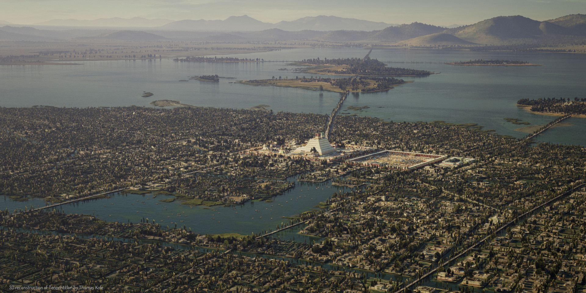
The year is 1518. Mexico-Tenochtitlan, once an unassuming settlement in the middle of Lake Texcoco, now a bustling metropolis. It is the capital of an empire ruling over, and receiving tribute from, more than 5 million people. Tenochtitlan is home to 200.000 farmers, artisans, merchants, soldiers, priests and aristocrats. At this time, it is one of the largest cities in the world.
Today, we call this city Ciudad de Mexico - Mexico City.
Not much is left of the old Aztec - or Mexica - capital Tenochtitlan. What did this city, raised from the lake bed by hand, look like? Using historical and archeological sources, and the expertise of many, I have tried to faithfully bring this iconic city to life.


The world looked very different 500 years ago. As you view these images, imagine the smell of salty air and smoked peppers. Imagine the sound of people speaking Nahuatl, a canoe gliding through the canals, and birds chirping in the trees. Imagine the warmth of the sun on your skin. The people around you are dressed in white cotton and work their fields, cook, trade, and practice their craft in the shade of trees and awnings.
The grid layout shows that Tenochtitlan is a city of hierarchy. Neighborhoods are planned in advance, each with its own markets, schools, and places of worship. Canals are maintained to allow for easy transport of goods and people. Walkways with bridges weave the city together.
Large buildings stand out against the single-story houses, from the massive twin-temple pyramids in the centers, to the smaller temples and shrines in neighborhood community centers. The Sacred Precinct, with the Templo Mayor, forms the epicenter of the city. Next to it is the palace of Emperor Motecuhzoma Xocoyotzin, among various other temples, schools, gardens, and a zoo.
Tenochtitlan has a twin city, Tlatelolco, a little to the north. Both cities grew and are now merged, with Tlatelolco subordinate to Tenochtitlan.
The city houses an important market, where merchants sell exotic goods from all over the Empire, and beyond.
The Basin of Mexico is surrounded by volcanoes - most famously Popocatepetl and Iztaccihuatl. The slopes guide rain and spring water down to form a salty inland sea. Even at its lowest point, the basin is well over 2000 meters above sea level.
Building a city in a lake means a permanent battle against water.
A complex system of causeways, canals, locks, and a 16 kilometer dike allows the Mexica to flush the city with fresh water from the mountains.
This compartmentalizing makes it so that the city is surrounded by brackish water, keeping the saltier water on the east side of the lake. An aqueduct from the Chapultepec hills provides the city with drinking water.
The Mexica create fertile plots of farmland by staking out pieces of the shallow lake and filling them with dirt and rubble. These chinampas are used to grow maize, beans, squash, peppers, and flowers.
This is what allowed the city to grow, both in area and in population.
The basin has been inhabited for millennia, many towns and cities have been built across the shores of the lake. Tenochtitlan, Tlacopan and Tetzcoco rule over the empire, as the Triple Alliance.
The city is connected to the mainland with causeways leading to Tlacopan, Azcapuzalco, Tepeyacac, and beyond.
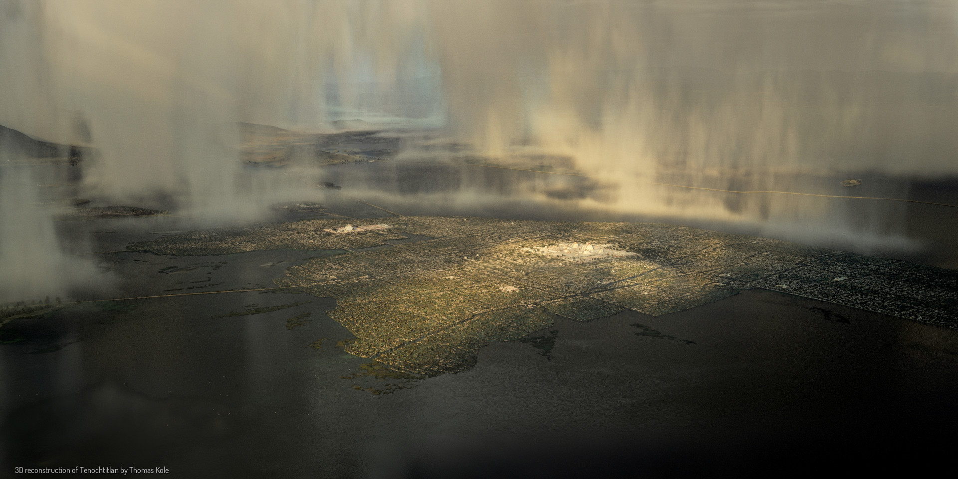
Mexico City is built on top of the ruins of Tenochtitlan. The temples were demolished and the stones were repurposed after the Spanish conquest. The lake has been drained, the canals made way for streets. Almost nothing of the original city remains. Using drone photography, we can compare the then and now. What similarities do you see?
Swipe across the images to compare.
To mark the ending of the 52-year cycle, all fires in the Basin of Mexico are extinguished and then lit again from a single source, in what is called the New Fire Ceremony.
The one in 1507 would be the last one held before the conquest.
This project is the result of over 1.5 years of research and iteration.
It would not have been possible without the input of the following people:
Paul Guinan
Michael E. Smith
Ian Mursell (mexicolore.co.uk)
Gerardo Gutierrez
Barbara E. Mundy
Tomas Filsinger
Patricia Murrieta-Flores
Mariana Favila Vázquez
José Luis de Rojas
Israel Hinojosa Baliño
Enrique Ortiz
@Lycaones
Gina Torres-Alves
Oswaldo Morales Napoles
Aldo Sauza
A list of references can be found here 🡥
These images are released under CC BY 4.0 (Creative Commons Attribution 4.0 International).
In short, this means that you can use these images freely, as long as they are correctly attributed.
a portrait of Tenochtitlan • Thomas Kole, 2023 – 2024